
Íomhá:Philippines relief location map (Palawan).svg

Size of this PNG preview of this SVG file: 377 × 377 picteilín. Other resolutions: 240 × 240 picteilín | 480 × 480 picteilín | 768 × 768 picteilín | 1,024 × 1,024 picteilín | 2,048 × 2,048 picteilín.
Taispeáin leagan ardtaifigh den íomhá (Comhad SVG, ainmniúil 377 × 377 picteilíni, méid comhaid: 2.21 MB)
| Seo comhad as An Cómhaoin Viciméid. Tá an tuairisc as an leathanach tuairisc Cómhaoin a leanas thíos.
Is stór comhaid meáin Saor é an Cómhaoin Viciméid. Is féidir leat cabhrú.
|
.svg)
Achoimriú
| Tuairisc |
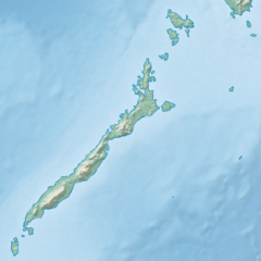
English: Physical location map of the Philippines (Palawan)
Equirectangular projection based on the parallel of 10°43' N
|
| Dáta | |
| Foinse | File:Philippines location map (square).svg |
| Údar | User:Hellerick |
| Leaganacha eile |
This file was derived from: Philippines relief location map (square).svg: .svg) |
.svg)
Ceadúnú
This file is licensed under the Creative Commons Attribution-Share Alike 3.0 Unported license.
- Is féidir:
- an saothar seo a roinnt – an saothar seo a chóipeáil, a dháil amach, agus a tharchur
- an saothar seo a athmheascadh – an saothar seo a oiriúnú
- Ach amháin má leantar na coinníollacha seo a leanas:
- sannadh – Ní mor creidiúint a thabhairt leis an saothar, faoi mar a shonraigh an údar nó tabharthóir an ceadúnais (ach ná húsáid modh a thugann le fios go thacaíonn sé/sí tú féin nó an úsáid a bhaineann tú as an saothar).
- comhroinn araon – Má athraíonn tú nó síneann tú amach an saothar seo, ní féidir é a dháileadh ach amhaín faoin gceadúnas céanna nó ceann cosúil leis an gceann seo.
Stair chomhaid
Cliceáil ar dáta/am chun an comhad a radharc mar a bhí sé ag an am sin.
| Dáta/Am | Mionsamhail | Toisí | Úsáideoir | Nóta tráchta | |
|---|---|---|---|---|---|
| faoi láthair | 17:23, 26 Deireadh Fómhair 2017 | | 377 × 377 (2.21 MB) | Mliu92 | User created page with UploadWizard |
Úsáid comhaid
Níl nasc ó aon leathanach eile don íomhá seo.
Global file usage
The following other wikis use this file:
- Úsáid ar ban.wikipedia.org
- Úsáid ar bcl.wikipedia.org
- Úsáid ar en.wikipedia.org
- Busuanga Island
- Tubbataha Reef
- Calamian Islands
- Puerto Princesa Subterranean River National Park
- Mindoro Strait
- Balabac Island
- Mangarin Bay
- Mount Mantalingajan
- Honda Bay
- Calauit Island
- Rasa Island
- Malampaya Sound
- Delian Island
- Module:Location map/data/Palawan
- Module:Location map/data/Palawan/doc
- Bacungan River
- Úsáid ar fa.wikipedia.org
- Úsáid ar fr.wikipedia.org
- Úsáid ar id.wikipedia.org
- Úsáid ar ilo.wikipedia.org
- Úsáid ar lv.wikipedia.org
- Úsáid ar ml.wikipedia.org
- Úsáid ar si.wikipedia.org
- Úsáid ar uz.wikipedia.org
.svg)